Sujet
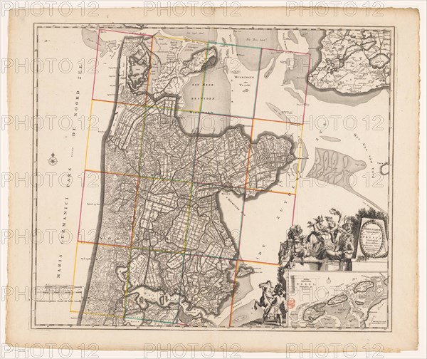
Map of Noord-Holland and part of Friesland, 1726-1750. Creator: Anon.
Légende
Map of Noord-Holland and part of Friesland, 1726-1750. At the bottom right the title cartouche with figures around it including a man with a horse, satyrs, putti, Mercury who takes the horn of plenty from a female figure, and a river god. Below that a deployment map of the Wadden area with scale.
Crédit
Photo12/Heritage Images/Heritage Art
Notre référence
HRM23A86_474
Model release
NA
Property release
NA
Licence
Droits gérés
Format disponible
84.1Mo (6.1Mo) / 50.1cm x 42.1cm / 5914 x 4972 (300dpi)