Sujet
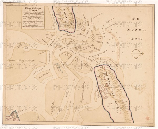
Map of Vlieland, Terschelling and the surrounding sandbanks, 1708 or later. Creator: Isaak de Graaf.
Légende
Map of Vlieland, Terschelling and the surrounding sandbanks, 1708 or later. At top left the title: 'Flie en Schellinger stroom' [stream], and a comment: 'Note the cyffers with black, mean fathoms [vadem]; With red, feet'. Possibly by Isaac de Graaf.
Crédit
Photo12/Heritage Images/Heritage Art
Notre référence
HRM23A85_203
Model release
NA
Property release
NA
Licence
Droits gérés
Format disponible
69.7Mo (2.6Mo) / 46.2cm x 37.8cm / 5452 x 4468 (300dpi)