Sujet
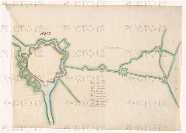
Map of Zwolle fortress, c.1650-c.1799. Creator: Anon.
Légende
Map of Zwolle fortress, c.1650-c.1799. In the centre a scale: range of 80 rods. Below that an inscription.
Crédit
Photo12/Heritage Images/Heritage Art
Notre référence
HRM23A84_409
Model release
NA
Property release
NA
Licence
Droits gérés
Format disponible
74.7Mo (2.2Mo) / 51.1cm x 36.6cm / 6038 x 4324 (300dpi)