Sujet
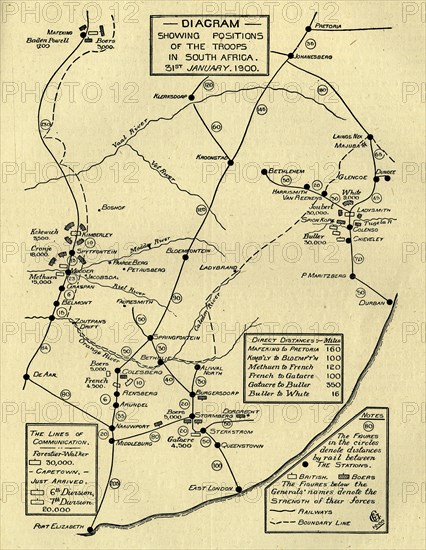
'Diagram Showing Positions of the Troops in South Africa, 31st January 1900', (c1900). Creator: Unknown.
Légende
'Diagram Showing Positions of the Troops in South Africa, 31st January 1900', (c1900). Boer Wars. Map showing lines of communication and the positions of the British and the Boers: 'The figures in the circles denote distances by rail between the stations...The Figures below the Generals' names denote the strength of their force [ie numbers of soldiers]'. From "Cassell's History of England, Vol. IX". [Cassell and Company, Limited, London, Paris, New York & Melbourne]
Crédit
Photo12/Heritage Images/The Print Collector
Notre référence
HRM23A77_075
Model release
NA
Licence
Droits gérés
Format disponible
62.5Mo (5.1Mo) / 34.8cm x 44.9cm / 4116 x 5309 (300dpi)