Sujet
Map of the London Postal District with its Subdivisions, 1857. Creator: Unknown.
Légende
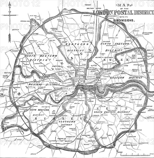
Map of the London Postal District with its Subdivisions, 1857. Districts shown: North Western, Northern, North Eastern, Eastern, South Eastern, Southern, South Western, Western, Western Centre, Eastern Centre. From "Illustrated London News", 1857.
Crédit
Photo12/Heritage Images/The Print Collector
Notre référence
HRM23A75_231
Model release
NA
Licence
Droits gérés
Format disponible
35.2Mo (2.3Mo) / 29.4cm x 30.1cm / 3467 x 3552 (300dpi)