Sujet
Plan of Constantinople and its Suburbs, 1856. Creator: John Dower.
Légende
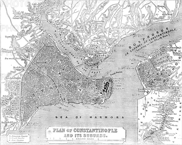
Plan of Constantinople and its Suburbs, 1856. Map showing the city of Constantinople (modern Istanbul, Turkey), including the 'Golden Horn or the Port'; the Bosphorus 'or Channel of Constantinople, leading to the Black Sea'; the Sea of Marmora, the 'Armenian, Frank and Jews' Quarters, pontoon bridge and the Seraglio. From "Illustrated London News", 1856.
Crédit
Photo12/Heritage Images
Notre référence
HRM23A57_191
Model release
NA
Property release
NA
Licence
Droits gérés
Format disponible
29.5Mo (3.0Mo) / 30.5cm x 24.2cm / 3607 x 2863 (300dpi)