Sujet
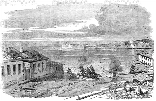
Sebastopol - Entrance to the Harbour, near Fort Nicholas - sketched by E. A. Goodall, 1856. Creator: Edward Alfred Goodall.
Légende
Sebastopol - Entrance to the Harbour, near Fort Nicholas - sketched by E. A. Goodall, 1856. View of the '...vast stronghold of the Russians in the Black Sea. The Harbour is the most important feature of Sebastopol...The entrance of the harbour is defended by strong batteries placed at the extremity of the two points of land that form the bay...About a mile from the mouth of the bay the grand port for vessels of war forms a sort of small arm, running in a south-west direction. This arm, which the Tartars used to call Kartali-Kosh (Vulture Bay), is now called Yujnaia- Bukhta or South Port. It is upwards of a mile and a half in length, with a width of 400 yards at the entrance, and has a little narrow creek of about 600 yards in length, in which ships can be laid up in ordinary in perfect safety'. From "Illustrated London News", 1856.
Crédit
Photo12/Heritage Images
Notre référence
HRM23A56_408
Model release
NA
Property release
NA
Licence
Droits gérés
Format disponible
25.0Mo (2.9Mo) / 31.1cm x 20.2cm / 3673 x 2382 (300dpi)