Sujet
Schleswig-Holstein War - Plan of Friedrichstadt, 1850. Creator: Unknown.
Légende
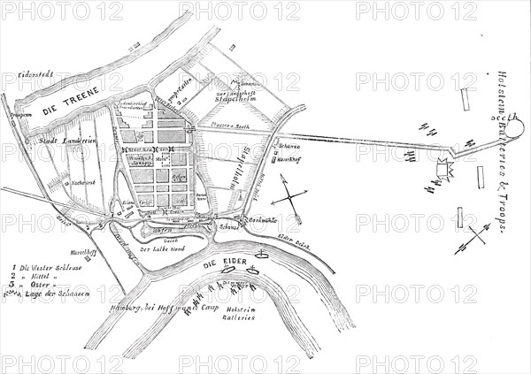
Schleswig-Holstein War - Plan of Friedrichstadt, [now in Germany], 1850. Map of the town and the river Eider showing three sluices: 'No. 1. Die Wester Schleuse. 2. Mittel. 3. Oster. The difficulty of storming the place will be seen, from there being only the one road marked below, across the marshy ground. It is now all under water in front of the town...Friedrichstadt...was, in 1620, a Friesland village, called Seebiil. Duke Frederick III., of Schleswig-Holstein, being applied to by a number of fugitives from Holland, persecuted Arminians, or remonstrants, permitted them to settle in this village, with full liberty to retain their own religious faith and forms. They reclaimed the neighbouring lands from the river by large dykes and sluices in the Dutch manner...The Lutheran Church has, it is said, been set on fire by the bombardment, and was burning when the last accounts left'. From "Illustrated London News", 1850.
Crédit
Photo12/Heritage Images/The Print Collector
Notre référence
HRM22A36_321
Model release
NA
Property release
NA
Licence
Droits gérés
Format disponible
49.7Mo (1.6Mo) / 42.0cm x 29.6cm / 4960 x 3499 (300dpi)