Sujet
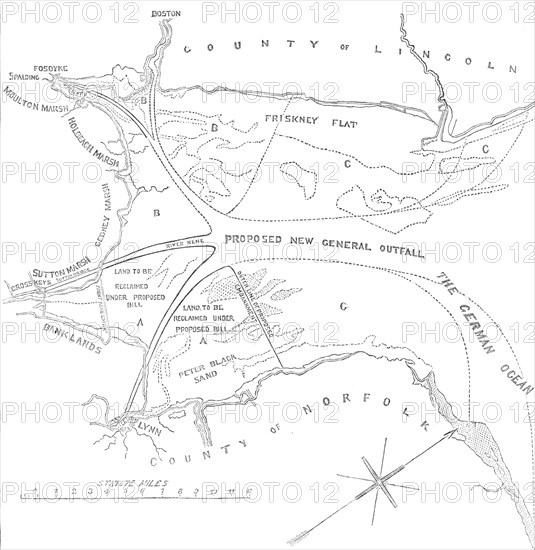
Plan of the Wash, between the Coasts of Norfolk and Lincolnshire, 1850. Creator: Unknown.
Légende
Plan of the Wash, between the Coasts of Norfolk and Lincolnshire, 1850. Map showing the proposed new general outfall and land to be reclaimed in the '...Norfolk Estuary, or Metaris Aestuarum...that broad open space of sands and channels, entirely covered at high tide...'. A civil engineering project to divert the course of the River Ouse and enable land reclamation, was undertaken by the Norfolk Estuary Company. 'Within the memory of persons still living, much of the district now arable was bog, and the passenger had to be conducted by guides across the swampy marsh, fordable only at low water...the late Sir J. Bennie had recommended the magnificent plan of entirely deviating the course of the Ouse from above [King's] Lynn, turning it on the opposite side of the town, and by a straight ship canal discharging its waters at once into the North Sea...'. From "Illustrated London News", 1850.
Crédit
Photo12/Heritage Images/The Print Collector
Notre référence
HRM22A36_163
Model release
NA
Property release
NA
Licence
Droits gérés
Format disponible
68.6Mo (1.6Mo) / 40.9cm x 42.0cm / 4831 x 4960 (300dpi)