Sujet
Map of North America, showing the...positions of Texas and Oregon with the United States, 1845. Creator: Unknown.
Légende
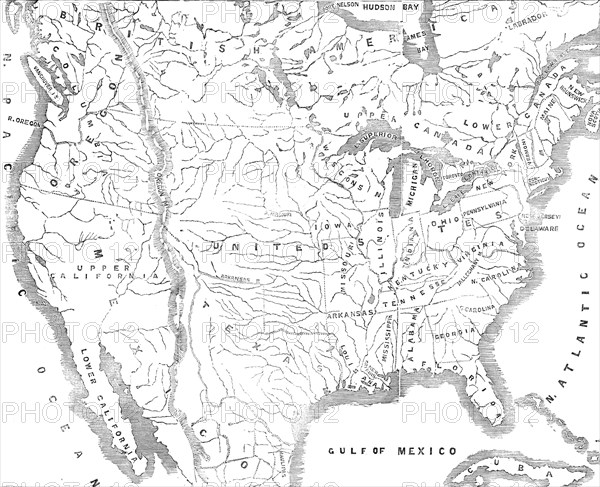
Map of North America, showing the relative positions of Texas and Oregon with the United States, 1845. 'It may...be requisite to subjoin here a few leading details of the Oregon Territory and its extent...On the east it skirts 800 miles along the Rocky Mountains, on the south 300 miles along the Snowy Mountains, on the west 700 miles along the Pacific Ocean, on the north 250 miles along the North American possessions of Russia and England...If America contends that a proprietary title has been acquired by the first visitations and explorations of her citizens, she can only be entitled to a very small portion of the territory; inasmuch as her citizens have visited but a very small portion of the country - the greater part of it having been pre-visited by the agents of the Hudson's Bay Company, who are the subjects of Great Britain'. From "Illustrated London News", 1845, Vol VII.
Crédit
Photo12/Heritage Images/The Print Collector
Notre référence
HRM21A07_167
Model release
NA
Property release
NA
Licence
Droits gérés
Format disponible
57.2Mo (3.3Mo) / 42.0cm x 34.1cm / 4960 x 4032 (300dpi)