Sujet
'Hereford World Map, c.1280', 1944. Creator: Richard de Bello.
Légende
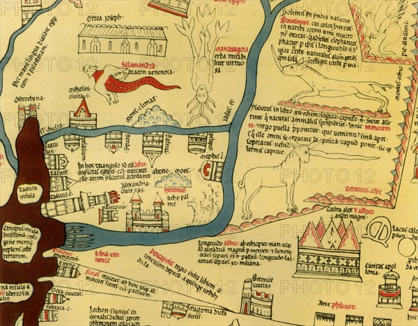
'Hereford World Map, c.1280', (1944). Detail showing the Mediterranean coast and the Nile Delta in northern Egypt. The lighthouse at Alexandria, complete with flames, can be seen next to the mouth of the River Nile. Also shown are mythical creatures such as the winged salamander, unicorn or monoceros, and mandragora, as well as a real rhinoceros. Part of the Hereford Mappa Mundi at Hereford Cathedral. Attributed to Richard de Bello, the Hereford Mappa Mundi, drawn on a single sheet of vellum, is the largest known existing medieval map. From "British Maps and Map-Makers", by Edward Lynam. [Collins, London, 1944]
Crédit
Photo12/Heritage Images/The Print Collector
Notre référence
HRM19G32_471
Model release
NA
Property release
NA
Licence
Droits gérés
Format disponible
61.1Mo (3.4Mo) / 44.3cm x 34.6cm / 5232 x 4083 (300dpi)