Sujet
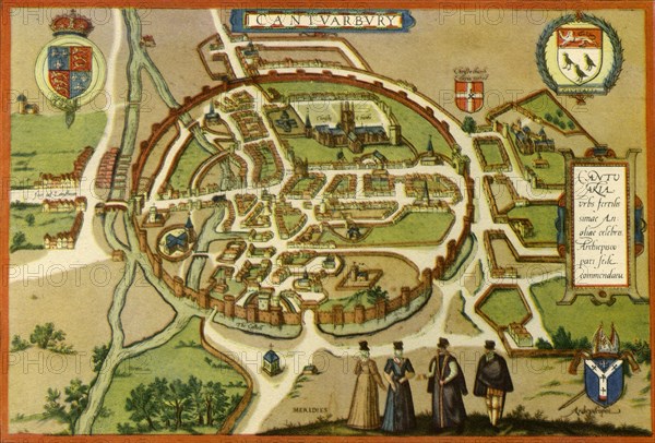
'Plan of Canterbury in the Sixteenth Century', (1943). Creator: Frans Hogenberg.
Légende
'Plan of Canterbury in the Sixteenth Century', (1943). Map of the walled city of 'Cantuarbury' in Kent, originally published c1580 by Georg Braun and Frans Hogenburg. The Latin text translates as: 'Canterbury, famous city in the very fertile county of England; notable as an archiepiscopal see'. From "English Cities and Small Towns", by John Betjeman. [Collins, London, 1943]
Crédit
Photo12/Heritage Images/The Print Collector
Notre référence
HRM19G32_379
Model release
NA
Property release
NA
Licence
Droits gérés
Format disponible
62.5Mo (4.2Mo) / 48.1cm x 32.5cm / 5680 x 3844 (300dpi)