Sujet
'Map of the Seat of War', 1900. Creator: Unknown.
Légende
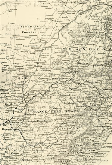
'Map of the Seat of War', 1900. Map of the Transvaal and the Orange Free State disputed territories between the British Empire, two Boer states, the South African Republic (Republic of Transvaal) and the Orange Free State, over the Empire's influence in South Africa. From "South Africa and the Transvaal War, Vol. III", by Louis Creswicke. [T. C. & E. C. Jack, Edinburgh, 1900]
Crédit
Photo12/Heritage Images/The Print Collector
Notre référence
HRM19G32_197
Model release
NA
Property release
NA
Licence
Droits gérés
Format disponible
63.1Mo (6.5Mo) / 32.7cm x 48.3cm / 3864 x 5705 (300dpi)