Sujet
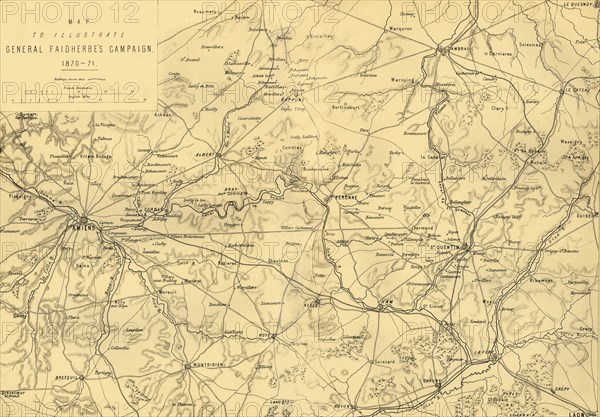
'Map to Illustrate General Faidherbe's Campaign 1870-71', c1872. Creator: R. Walker.
Légende
'Map to Illustrate General Faidherbe's Campaign 1870-71', (c1872). Map of northern France: 'Drawn under the Superintendance of Captain Hozier', showing the towns of Amiens, Cambrai, St Quentin and Laon. French military commander Louis Faidherbe was ordered to attack the Prussians - he led his forces into an open battle at St Quentin and his army was defeated in January 1871. From "The Franco-Prussian War: its causes, incidents and consequences", Volume II, by Captain H M Hozier. [William Mackenzie, London, 1872]
Crédit
Photo12/Heritage Images/The Print Collector
Notre référence
HRM19G32_024
Model release
NA
Property release
NA
Licence
Droits gérés
Format disponible
60.5Mo (6.1Mo) / 46.6cm x 32.5cm / 5508 x 3837 (300dpi)