Sujet
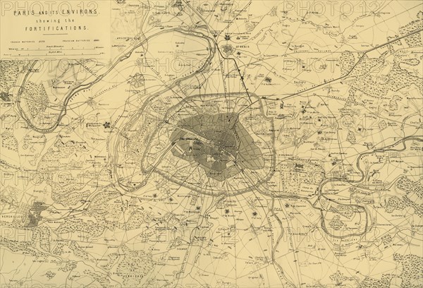
'Paris and its Environs, showing the Fortifications', (c1872). Creator: R. Walker.
Légende
'Paris and its Environs, showing the Fortifications', (c1872). Map: 'Drawn under the Superintendence of Captain Hozier, showing French and Prussian batteries (artillery positions). After the disastrous defeat of the French at Sedan and the capture of Napoleon III, the Prussians surrounded Paris on 9 September 1870. The city held out despite famine, disease and cold until a bombardment with heavy siege guns led to its surrender on 28 January 1871. From "The Franco-Prussian War: its causes, incidents and consequences", Volume II, by Captain H M Hozier. [William Mackenzie, London, 1872]
Crédit
Photo12/Heritage Images/The Print Collector
Notre référence
HRM19G32_023
Model release
NA
Property release
NA
Licence
Droits gérés
Format disponible
61.9Mo (7.7Mo) / 47.8cm x 32.5cm / 5640 x 3838 (300dpi)