Sujet
Map of the Battle of Gravelotte, 18 August 1870, (c1872). Creator: R. Walker.
Légende
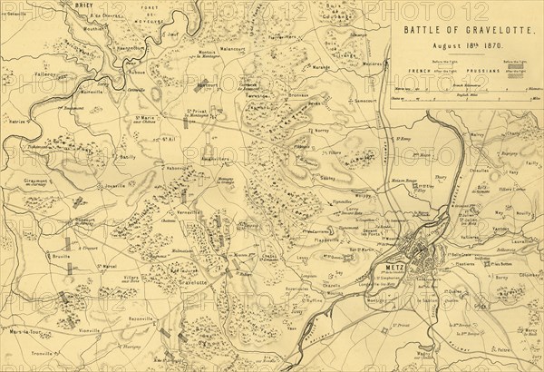
Map of the Battle of Gravelotte, 18 August 1870, (c1872). Map: 'Drawn under the Superintendance of Captain Hozier', showing the enemy positions. The Battle of Gravelotte, the largest engagement of the Franco-Prussian War, was fought near Gravelotte, a village in Lorraine between the city of Metz and the former French-German frontier. From "The Franco-Prussian War: its causes, incidents and consequences", Volume I, by Captain H M Hozier. [William Mackenzie, London, 1872]
Crédit
Photo12/Heritage Images/The Print Collector
Notre référence
HRM19G32_010
Model release
NA
Property release
NA
Licence
Droits gérés
Format disponible
62.2Mo (6.7Mo) / 47.7cm x 32.7cm / 5633 x 3858 (300dpi)