Sujet
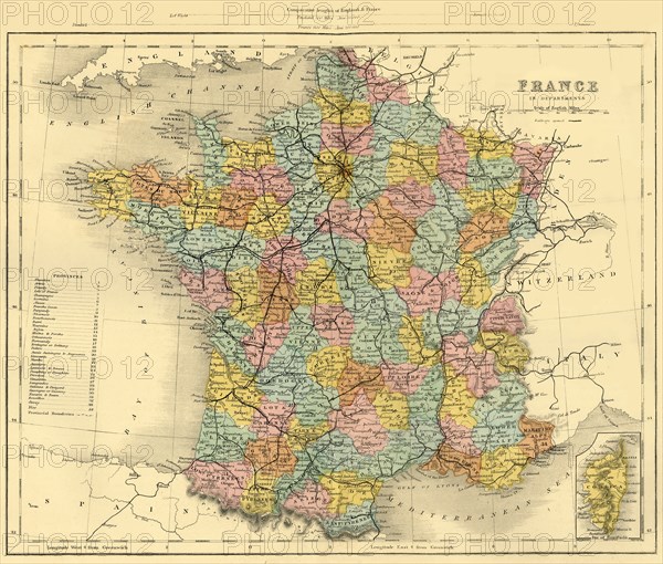
Map of France, c1872. Creator: Unknown.
Légende
Map of France, c1872. Showing the départements or provinces, including the island of Corsica, (inset bottom right). From "The Franco-Prussian War: its causes, incidents and consequences", Volume I, by Captain H M Hozier. [William Mackenzie, London, 1872]
Crédit
Photo12/Heritage Images/The Print Collector
Notre référence
HRM19G31_500
Model release
NA
Property release
NA
Licence
Droits gérés
Format disponible
65.3Mo (6.9Mo) / 43.9cm x 37.3cm / 5181 x 4407 (300dpi)