Sujet
'Map of Poland Showing Position of Conflicting Nations on July 24th, 1915', 1916. Creator: Unknown.
Légende
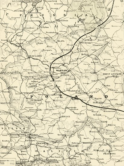
'Map of Poland Showing Position of Conflicting Nations on July 24th, 1915', 1916. Because of its' geographical position between fighting powers, Poland saw much fighting and terrific human and material losses between 1914 and 1918. From "The War Illustrated Album De Luxe - Volume IV. The Summer Campaign - 1915", edited by J. A. Hammerton. [The Amalgamated Press, Limited, London, 1916]
Date
1916
Crédit
Photo12/Heritage Images/The Print Collector
Notre référence
HRM19F29_245
Model release
NA
Property release
NA
Licence
Droits gérés
Format disponible
60.7Mo (3.2Mo) / 33.7cm x 45.1cm / 3984 x 5324 (300dpi)