Sujet
'Map Showing the German Cameroon Colony', 1916. Creator: Unknown.
Légende
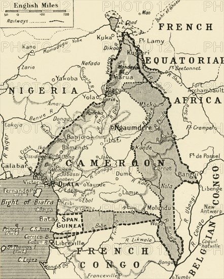
'Map Showing the German Cameroon Colony', 1916. German Cameroon was an African colony of the German Empire from 1884 to 1916. Following Germany's defeat, the Treaty of Versailles divided the territory between Great Britain and France. From "The War Illustrated Album De Luxe - Volume IV. The Summer Campaign - 1915", edited by J. A. Hammerton. [The Amalgamated Press, Limited, London, 1916]
Date
1916
Crédit
Photo12/Heritage Images/The Print Collector
Notre référence
HRM19F29_239
Model release
NA
Property release
NA
Licence
Droits gérés
Format disponible
59.1Mo (2.5Mo) / 34.5cm x 42.9cm / 4074 x 5068 (300dpi)