Sujet
'Germany's Western Frontier under the terms of the Peace Treaty', 1918, (c1920). Creator: Unknown.
Légende
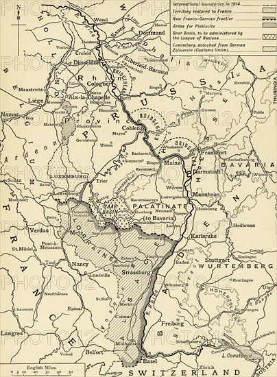
'Germany's Western Frontier under the terms of the Peace Treaty', 1918, (c1920). Map showing the border between France and Germany after the signing of the armistice at the end of the First World War. Also shown are: 'International boundaries in 1914; Territory restored to France; New Franco-German frontier; Areas for Plebiscite; Saar Basin, to be administered by the League of Nations; Luxembourg, detached from German Zollverein (Customs Union)'. From "The Great World War: A History", Volume IX, edited by Frank A Mumby. [The Gresham Publishing Company Ltd, London, c1920]
Date
1918
Crédit
Photo12/Heritage Images/The Print Collector
Notre référence
HRM19F27_475
Model release
NA
Property release
NA
Licence
Droits gérés
Format disponible
60.9Mo (5.8Mo) / 33.5cm x 45.6cm / 3954 x 5382 (300dpi)