Sujet
'Map illustrating the Brest-Litovsk Treaties', First World War, c1918, (c1920). Creator: Unknown.
Légende
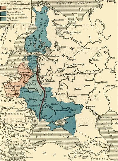
'Map illustrating the Brest-Litovsk Treaties', First World War, c1918, (c1920). Pink: 'Areas taken by Germany'; dark blue: 'Nationalities of self-determination'; light blue: 'Area to be evacuated by Germany'. The Treaty of Brest-Litovsk, also known as the Brest Peace in Russia, was a peace treaty signed on 3 March 1918 between the new Bolshevik government of Russia and the Central Powers (German Empire, Austria-Hungary, Bulgaria, and the Ottoman Empire), that ended Russia's participation in World War I. From "The Great World War: A History", Volume VII, edited by Frank A Mumby. [The Gresham Publishing Company Ltd, London, c1920]
Date
1918
Crédit
Photo12/Heritage Images/The Print Collector
Notre référence
HRM19F27_448
Model release
NA
Property release
NA
Licence
Droits gérés
Format disponible
61.2Mo (4.8Mo) / 33.5cm x 45.7cm / 3960 x 5400 (300dpi)