Sujet
'Poland and the Partitions of 1772, 1793 & 1795', (c1920). Creator: John Bartholomew & Son.
Légende
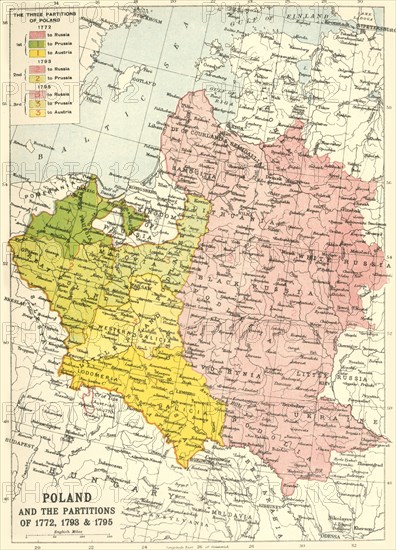
'Poland and the Partitions of 1772, 1793 & 1795', (c1920). Map showing how territory in Europe was divided between the empires of Russia, Prussia and Austria in the 18th century. From "The Great World War - A History" Volume IV, edited by Frank A Mumby. [The Gresham Publishing Company Ltd, London, c1920]
Date
1914
Crédit
Photo12/Heritage Images/The Print Collector
Notre référence
HRM19F26_097
Model release
NA
Property release
NA
Licence
Droits gérés
Format disponible
61.9Mo (3.6Mo) / 33.5cm x 46.4cm / 3951 x 5475 (300dpi)