Sujet
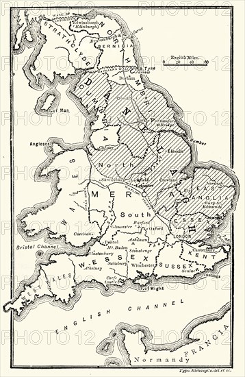
'Map of England, Showing Anglo-Saxon Kingdoms and Danish Districts'
Légende
'Map of England, Showing the Anglo-Saxon Kingdoms and the Danish Districts (The Latter Shaded)', (c9th century), 1890. The Heptarchy is a collective name applied to the seven kingdoms of Anglo-Saxon settlement of Britain in the 5th century. During the 9th century, about half of England was under Danish rule. From "Cassell's Illustrated Universal History, Vol. III - The Middle Ages", by Edmund Ollier. [Cassell and Company, Limited, London, Paris and Melbourne, 1890. ]
Date
1890
Crédit
Photo12/Heritage Images/The Print Collector
Notre référence
HRM19F25_046
Model release
Non
Licence
Droits gérés
Format disponible
63.5Mo (3.1Mo) / 32.2cm x 49.4cm / 3801 x 5835 (300dpi)