Sujet
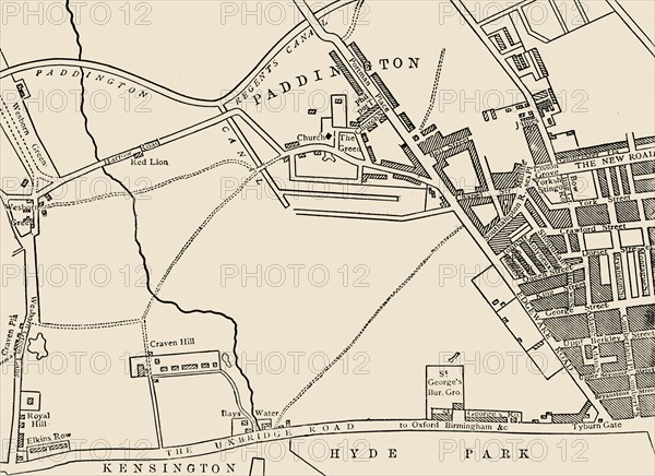
'Map of Paddington, in 1815'
Légende
'Map of Paddington, in 1815', (c1876). Paddington, in the City of Westminster had Roman roads on north-eastern and southern boundaries which became toll roads in 18th century. From "Old and New London: A Narrative of Its History, Its People, and Its Places. The Western and Northern Studies", by Edward Walford. [Cassell, Petter, Galpin & Co., London, Paris & New York]
Date
1815
Crédit
Photo12/Heritage Images/The Print Collector
Notre référence
HRM19F22_478
Model release
Non
Licence
Droits gérés
Format disponible
59.4Mo (1.9Mo) / 45.3cm x 32.9cm / 5345 x 3887 (300dpi)