Sujet
'Map of Belgravia, 1814'
Légende
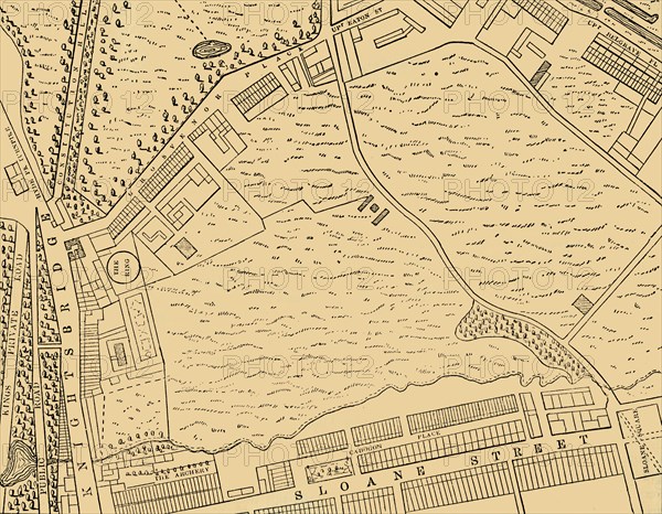
'Map of Belgravia, 1814', (c1876). Developed in the early 19th century by Richard Grosvenor, 2nd Marquess of Westminster under the direction of Thomas Cubitt, Belgravia is one of the wealthiest districts in the world. From "Old and New London: A Narrative of Its History, Its People, and Its Places. The Western and Northern Studies", by Edward Walford. [Cassell, Petter, Galpin & Co., London, Paris & New York]
Date
1814
Crédit
Photo12/Heritage Images/The Print Collector
Notre référence
HRM19F22_380
Model release
Non
Licence
Droits gérés
Format disponible
63.0Mo (3.3Mo) / 45.0cm x 35.1cm / 5320 x 4140 (300dpi)