Sujet
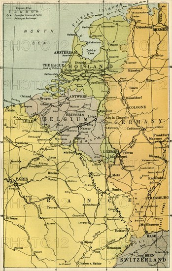
Map of the Belgian Frontier with Forts', 1919.
Légende
'Map of the Belgian Frontier with Forts', 1919. Map showing Belgium, Holland and parts of Germany and France during the First World War, 1914-1919. Fortified towns and principal railways are indicated. From "The History of the Great European War: its causes and effects", Vol. I, by W. Stanley Macbean Knight. [Caxton Pulishing Company, Limited, London, 1919]
Date
1919
Crédit
Photo12/Heritage Images/The Print Collector
Notre référence
HRM19F15_291
Model release
Non
Licence
Droits gérés
Format disponible
60.7Mo (6.1Mo) / 31.1cm x 48.9cm / 3671 x 5778 (300dpi)