Sujet
Map To Illustrate the Battle of the Somme', (1919).
Légende
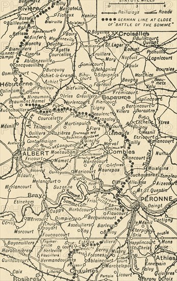
'Map To Illustrate the Battle of the Somme', (1919). The First World War Battle of the Somme, fought between the armies of the British Empire and French Third Republic against the German Empire, took place between 1 July and 18 November 1916 on both sides of the River Somme in northern France. Railways, roads and German lines are shown. From "The History of the Great European War: its causes and effects", Vol. VI, by W. Stanley Macbean Knight. [Caxton Pulishing Company, Limited, London, 1919]
Date
1919
Crédit
Photo12/Heritage Images/The Print Collector
Notre référence
HRM19F15_074
Model release
Non
Licence
Droits gérés
Format disponible
60.5Mo (4.4Mo) / 30.9cm x 49.0cm / 3654 x 5784 (300dpi)