Sujet
The Eastern Frontier', 1919.
Légende
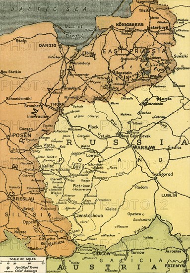
'The Eastern Frontier', 1919. Map showing parts of Germany, Prussia, Russia and Austria during the First World War, 1914-1919, with fortified towns and main railway lines indicated. From "The History of the Great European War: its causes and effects", Vol. III, by W. Stanley Macbean Knight. [Caxton Pulishing Company, Limited, London, 1919]
Date
1919
Crédit
Photo12/Heritage Images/The Print Collector
Notre référence
HRM19F15_070
Model release
Non
Licence
Droits gérés
Format disponible
60.0Mo (5.8Mo) / 32.4cm x 46.5cm / 3822 x 5488 (300dpi)