Sujet
Map To Illustrate the German Submarine Blockade and the British Minefields...', 1919.
Légende
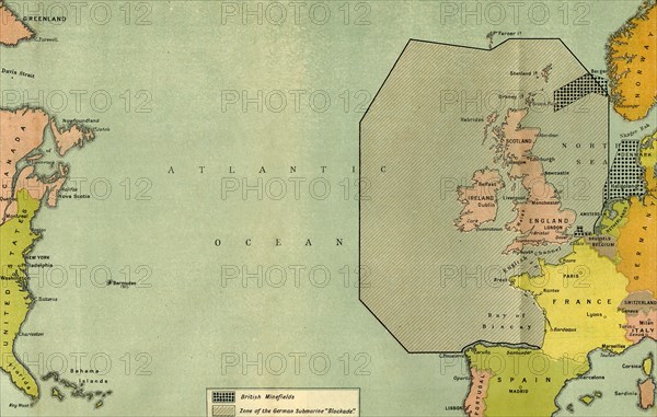
'Map To Illustrate the German Submarine Blockade and the British Minefields as a Measure of Protection', 1919. Map of the Atlantic Ocean during the First World War, 1914-1919, showing part of the east coast of the United States, Great Britain and western Europe. From "The History of the Great European War: its causes and effects", Vol. VII, by W. Stanley Macbean Knight. [Caxton Pulishing Company, Limited, London, 1919]
Date
1919
Crédit
Photo12/Heritage Images/The Print Collector
Notre référence
HRM19F14_499
Model release
Non
Licence
Droits gérés
Format disponible
60.9Mo (6.1Mo) / 49.0cm x 31.1cm / 5789 x 3678 (300dpi)