Sujet
Map To Illustrate The Campaign in Palestine', 1919.
Légende
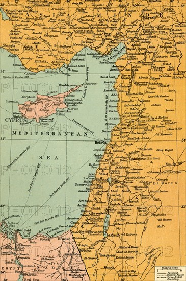
'Map To Illustrate The Campaign in Palestine', 1919. Map of the Eastern Mediterrean and the Middle East, showing Cyprus, Port Said in Egypt, parts of Turkey and what are now Syria, the Lebanon, Israel and the Occupied Territories including Gaza. From "The History of the Great European War: its causes and effects", Vol. IX, by W. Stanley Macbean Knight. [Caxton Pulishing Company, Limited, London, 1919]
Date
1919
Crédit
Photo12/Heritage Images/The Print Collector
Notre référence
HRM19F14_399
Model release
Non
Licence
Droits gérés
Format disponible
60.9Mo (6.5Mo) / 31.9cm x 47.9cm / 3762 x 5658 (300dpi)