Sujet
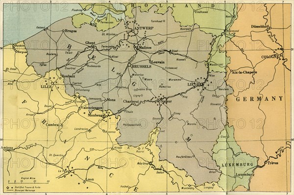
A General Map of Belgium, Indicating the Fortified Towns', 1919.
Légende
'A General Map of Belgium, Indicating the Fortified Towns', 1919. Map of territory in which fighting took place during the First World War, also showing principal railways. From "The History of the Great European War: its causes and effects", Vol. II, by W. Stanley Macbean Knight. [Caxton Pulishing Company, Limited, London, 1919]
Date
1919
Crédit
Photo12/Heritage Images/The Print Collector
Notre référence
HRM19F14_372
Model release
Non
Licence
Droits gérés
Format disponible
63.9Mo (5.9Mo) / 49.1cm x 32.6cm / 5795 x 3852 (300dpi)