Sujet
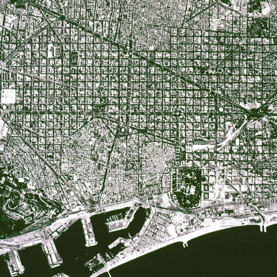
Aerial View of 'L'Eixample' map, know as 'Plan Cerdá' of the city of Barcelona, ??renovation and ?
Légende
Aerial View of 'L'Eixample' map, know as 'Plan Cerdá' of the city of Barcelona, ??renovation and expansion that took place in 1860.
Crédit
Photo12/Heritage Images/Index
Notre référence
HRM19E92_281
Model release
Non
Licence
Droits gérés
Format disponible
21,7Mo (1,8Mo) / 23,3cm x 23,3cm / 2756 x 2755 (300dpi)