Sujet
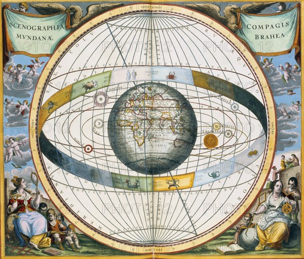
Map showing Tycho Brahe's system of planetary orbits around the Earth, 1660-1661. Artist: Andreas Cellarius
Légende
Map showing Tycho Brahe's system of planetary orbits around the Earth, 1660-1661. From The Celestial Atlas, or The Harmony of the Universe (Atlas coelestis seu harmonia macrocosmica) by Andreas Cellarius, published by Johannes Janssonius, (Amsterdam 1660-1661).
Historica Graphica Collection
Date
1837
Crédit
Photo12/Heritage Images/Historica Graphica Collection
Notre référence
HRM19D59_113
Model release
Non
Licence
Droits gérés
Format disponible
50.5Mo (3.2Mo) / 38.5cm x 32.9cm / 4548 x 3883 (300dpi)