Sujet
'Cripplegate and Neighbourhood', (c1872). Creator: Unknown.
Légende
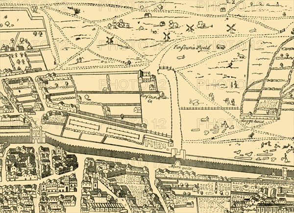
'Cripplegate and Neighbourhood', (c1872). Map of part of the City of London dating from before the development of Finsbury Square in 1777. This area was previously a green space to the north of the City, here shown as 'Finsburie Fyeld' (Finsbury Field). Also shown are the old Roman walls and More gate (Moorgate). From Old and New London, Vol. II: A Narrative of Its History, Its People, and Its Places, by Walter Thornbury. [Cassell, Petter, Galpin & Co., London, Paris & New York]
The Print Collector collection
Date
1872
Crédit
Photo12/Heritage Images/The Print Collector
Notre référence
HRM19D50_183
Model release
Non
Licence
Droits gérés
Format disponible
62.1Mo (2.7Mo) / 46.3cm x 33.6cm / 5466 x 3970 (300dpi)