Sujet
'Old Map of the Ward of Cheap - About 1750', (1897). Creator: Unknown.
Légende
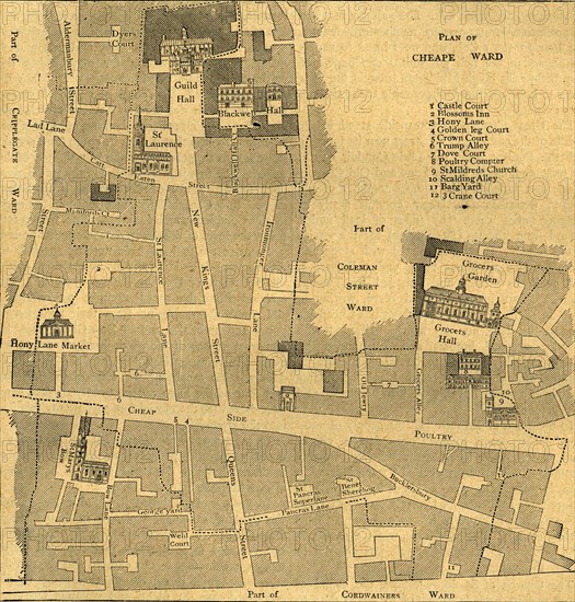
'Old Map of the Ward of Cheap - About 1750', (1897). Map of part of the City of London, showing: Castle Court, Blossoms Inn, Hony Lane, Golden leg Court, Crown Court, Trump Alley, Dove Court, Poultry Compter, St Mildred's Church, Scalding Alley, Barg Yard and Crane Court, as well the Guildhall, Grocers Hall, and the church of St Mary-le-Bow. From Old and New London, Volume I, by Walter Thornbury. [Cassell and Company, Limited, London, Paris & Melbourne, 1897]
The Print Collector collection
Date
1897
Crédit
Photo12/Heritage Images/The Print Collector
Notre référence
HRM19D50_060
Model release
Non
Licence
Droits gérés
Format disponible
58.7Mo (9.6Mo) / 37.5cm x 39.2cm / 4426 x 4634 (300dpi)