Sujet
Map of Scotland, 1902. Creator: Unknown.
Légende
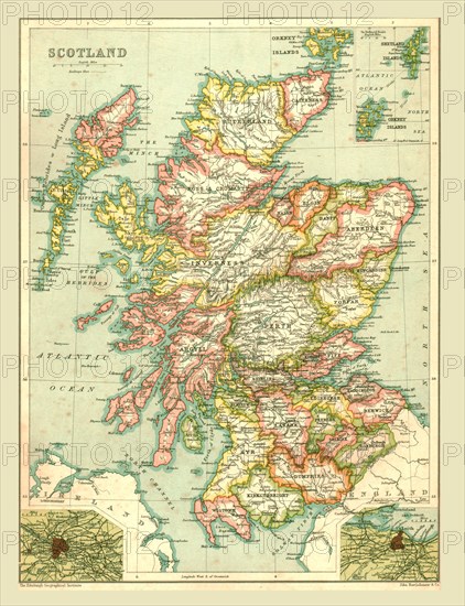
Map of Scotland, 1902. Showing the various counties and islands including the Hebrides, the Shetlands and the Orkneys, and an inset of the rail networks of Glasgow and Edinburgh. From The Century Atlas of the World. [John Walker & Co, Ltd., London, 1902]
The Print Collector collection
Date
1902
Crédit
Photo12/Heritage Images/The Print Collector
Notre référence
HRM19D46_334
Model release
Non
Licence
Droits gérés
Format disponible
47.0Mo (5.0Mo) / 30.1cm x 39.1cm / 3550 x 4624 (300dpi)