Sujet
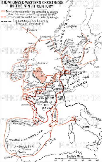
'Map of the Vikings & Western Christendom in the Ninth Century', (1935). Artist: Unknown.
Légende
'Map of the Vikings & Western Christendom in the Ninth Century', (1935). Modern map showing territories occupied, controlled or raided by the Vikings (roughly 793-1066 AD). From A History of the Anglo-Saxons, Vol. II, by R. H. Hodgkin. [The Clarendon Press, Oxford, 1935]
The Print Collector collection
Date
1935
Crédit
Photo12/Heritage Images/The Print Collector
Notre référence
HRM19D45_495
Model release
Non
Licence
Droits gérés
Format disponible
30.9Mo (1.0Mo) / 22.1cm x 35.0cm / 2616 x 4128 (300dpi)