Sujet
Map of Rathbone Place and its neighbourhood, Westminster, London, 1746 (1878). Artist: Unknown.
Légende
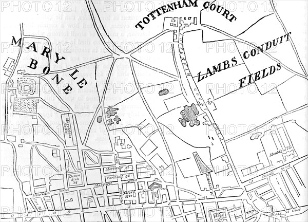
Map of Rathbone Place and its neighbourhood, Westminster, London, 1746 (1878). From John Rocque's Maps of London. John Rocque (1709-1762) created an extensive map of Georgian London in 1746. From Old and New London Illustrated, Vol IV, by Edward Walford. [Cassell Petter & Galpin, London, Paris & New York, 1878]
The Print Collector collection
Date
1878
Crédit
Photo12/Heritage Images/The Print Collector
Notre référence
HRM19C79_046
Model release
Non
Licence
Droits gérés
Format disponible
102.2Mo (3.0Mo) / 59.6cm x 43.0cm / 7035 x 5076 (300dpi)