Sujet
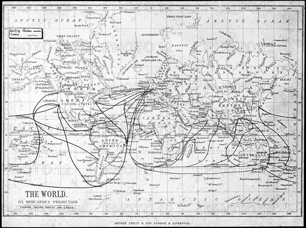
Map of the world showing sailing routes and telegraph cables, c1893. Artist: George Philip & Son Ltd
Légende
Map of the world showing sailing routes and telegraph cables, c1893. From Outlines of British Colonisation, by William Henry Parr Greswell.
The Print Collector collection
Date
1893
Crédit
Photo12/Heritage Images/The Print Collector
Notre référence
HRM19C60_456
Model release
Non
Licence
Droits gérés
Format disponible
50.1Mo (4.1Mo) / 41.0cm x 30.6cm / 4846 x 3612 (300dpi)