Sujet
Atlantis: a map showing the location of the mythical continent, c1882 (1956). Artist: Unknown
Légende
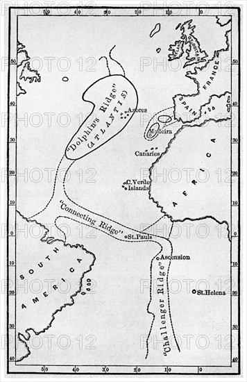
Atlantis: a map showing the location of the mythical continent, c1882 (1956). Showing its islands and connecting ridges, from deep sea soundings, from Atlantis: the Antediluvian World by Ignatius L Donnelly. Donnelly (1831-1901) was an American politician, writer and fringe scientist. His book on Atlantis, published in 1882, was a best seller, creating a mania for the idea of the legendary continent that persists to this day.
The Print Collector collection
Date
1956
Crédit
Photo12/Heritage Images/The Print Collector
Notre référence
HRM19C53_135
Model release
Non
Licence
Droits gérés
Format disponible
50.0Mo (2.3Mo) / 28.5cm x 44.0cm / 3365 x 5196 (300dpi)