Sujet
Map showing the Siege of Sevastopol, Crimean War, 1854-1855, (1893).Artist: Robert Walker
Légende
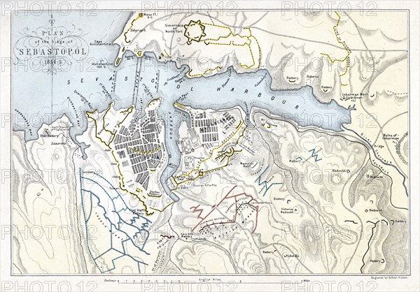
Map showing the Siege of Sevastopol, Crimean War, 1854-1855, (1893). The Siege of Sevastopol, lasted from September 1854 until September 1855. In September 1854, Allied troops (United Kingdom, French and Sardinian) landed in the Crimea and besieged the city of Sevastopol, home of the Tsar's Black Sea fleet which threatened the Mediterranean. An engraving from James Taylor's The Age We Live In: A History of the Nineteenth Century, From the Peace of 1815 to the Present Time, William Mackenzie, (London, 1893).
The Print Collector collection
Date
1893
Crédit
Photo12/Heritage Images/The Print Collector
Notre référence
HRM19C12_375
Model release
Non
Licence
Droits gérés
Format disponible
50.1Mo (5.4Mo) / 42.4cm x 29.6cm / 5010 x 3492 (300dpi)