Sujet
Map showing the eruption of Mount Pelee, Martinique, 1902. Artist: Unknown
Légende
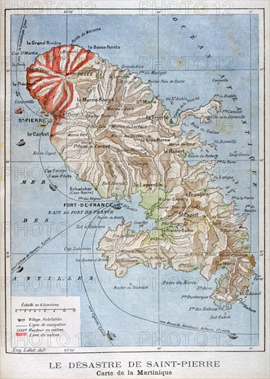
Map showing the eruption of Mount Pelee, Martinique, 1902. The catastrophic eruption of Mount Pelee on Martinique in 1902 was the worst volcanic disaster of the 20th century. The eruption created a pyroclastic flow which caused between 26,000 to 36,000 casualties and destroyed the city of Saint-Pierre. An illustration from Le Petit Journal, 25th May 1902.
Date
1902
Crédit
Photo12/Heritage Images/Art Media
Notre référence
HRM19C03_144
Model release
Non
Licence
Droits gérés
Format disponible
50.0Mo (3.9Mo) / 29.9cm x 41.9cm / 3533 x 4947 (300dpi)