Sujet
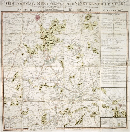
Map of the Waterloo campaign, 1815, Walmer Castle, Kent
Légende
Map of the Waterloo campaign, 1815, Walmer Castle, Kent. Map Exhibiting the Situation of the Armies on the 16, 17 & 18 of June 1815. The Battle of Ligny, Quatre Bras, Waterloo and Wavre.
Date
1815
Crédit
Photo12/Heritage Images/Historic England Archive
Notre référence
HRM19B40_235
Model release
Non
Licence
Droits gérés
Format disponible
38.3Mo (3.0Mo) / 30.7cm x 31.3cm / 3623 x 3691 (300dpi)