Sujet
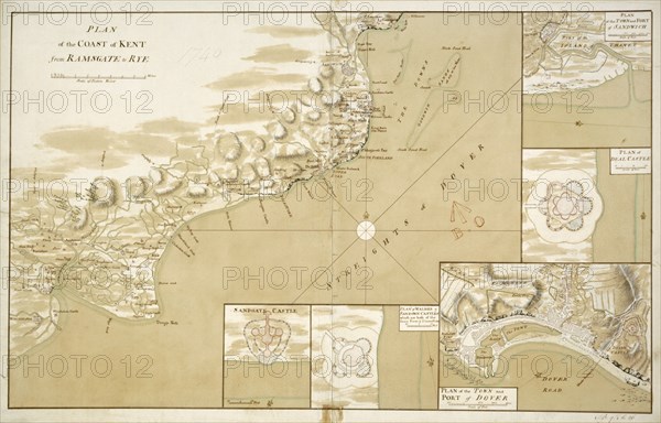
Plan of the coast of Kent from Ramsgate to Rye', 1740
Légende
'Plan of the coast of Kent from Ramsgate to Rye', 1740. Chart of the approaches to the Kent coast showing details of the coastal defences at Sandwich, Deal, Dover, Walmer and Sandgate. Map in the collection of Walmer Castle, Kent.
Date
1740
Crédit
Photo12/Heritage Images/Historic England Archive
Notre référence
HRM19B38_482
Model release
Non
Licence
Droits gérés
Format disponible
50.0Mo (2.4Mo) / 44.2cm x 28.3cm / 5221 x 3347 (300dpi)