Sujet
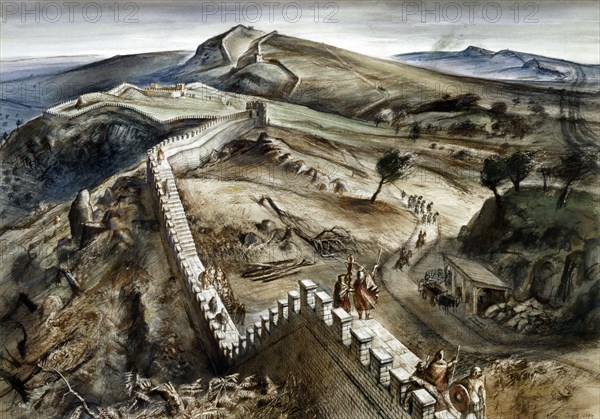
Walltown Crags, Hadrian's Wall, c2nd century, (c1960s)
Légende
Walltown Crags, Hadrian's Wall, c2nd century, (c1960s). Reconstruction drawing. A defensive fortification in the Roman province of Britannia, begun in 122 AD in the reign of the emperor Hadrian. It ran from the banks of the River Tyne near the North Sea to the Solway Firth on the Irish Sea, and was the northern limit of the Roman Empire. Walltown Crags is perhaps the most scenic place to view Hadrian's Wall.
Date
1960
Crédit
Photo12/Heritage Images/Historic England Archive
Notre référence
HRM19B34_383
Model release
Non
Licence
Droits gérés
Format disponible
50.0Mo (3.6Mo) / 42.3cm x 29.6cm / 4997 x 3497 (300dpi)