Sujet
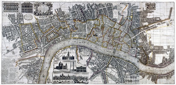
Map of the City of London, City of Westminster, River Thames, Lambeth and Southwark, 1736. Artist: Anon
Légende
Map of the City of London, City of Westminster, River Thames, Lambeth and Southwark, 1736. Top left shows two elevations of Banqueting House and Treasury. Lower section shows views of the Royal Exchange, Bank of England, Monument and the River Thames.
Date
1736
Crédit
Photo12/Heritage Images/City of London : The London Archives
Notre référence
HRM19A97_499
Model release
NA
Property release
NA
Licence
Droits gérés
Format disponible
30.5Mo (2.6Mo) / 39.6cm x 19.3cm / 4676 x 2277 (300dpi)