Sujet
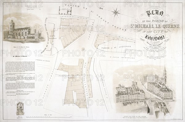
Map of the parish of St Michael le Querne, London, 1853. Creator: King.
Légende
Map of the parish of St Michael le Querne, London, 1853.
Date
1853
Crédit
Photo12/Heritage Images/City of London : The London Archives
Notre référence
HRM19A97_173
Model release
NA
Property release
NA
Licence
Droits gérés
Format disponible
18.0Mo (980.6Ko) / 26.1cm x 17.3cm / 3084 x 2039 (300dpi)