Sujet
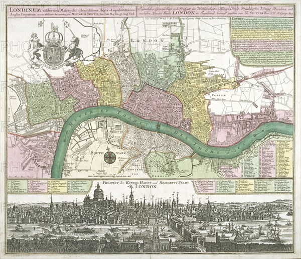
Map of Westminster, the City of London and Southwark, 1720. Artist: Johann Thomas Kraus
Légende
Map of Westminster, the City of London and Southwark, 1720. With the royal arms in the top left corner and a list of wards and parishes. A prospect of London from Temple to Wapping appears in the bottom margin with a key to principal landmarks.
Date
1720
Crédit
Photo12/Heritage Images/City of London : The London Archives
Notre référence
HRM19A97_172
Model release
NA
Property release
NA
Licence
Droits gérés
Format disponible
18.0Mo (2.0Mo) / 22.9cm x 19.7cm / 2701 x 2326 (300dpi)