Sujet
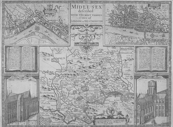
Maps of London, 1610. Artist: Anon
Légende
Maps of London, 1610. The upper left section shows the City of Westminster and River Thames. The upper right section shows the City of London and River Thames. The central section shows a map of Greater London and surrounding counties. The panels in the bottom corners show Westminster Abbey (left) and the old St Paul's Cathedral (right).
Date
1610
Crédit
Photo12/Heritage Images/City of London : The London Archives
Notre référence
HRM19A97_020
Model release
NA
Property release
NA
Licence
Droits gérés
Format disponible
18.0Mo (1.5Mo) / 24.8cm x 18.2cm / 2927 x 2144 (300dpi)