Sujet
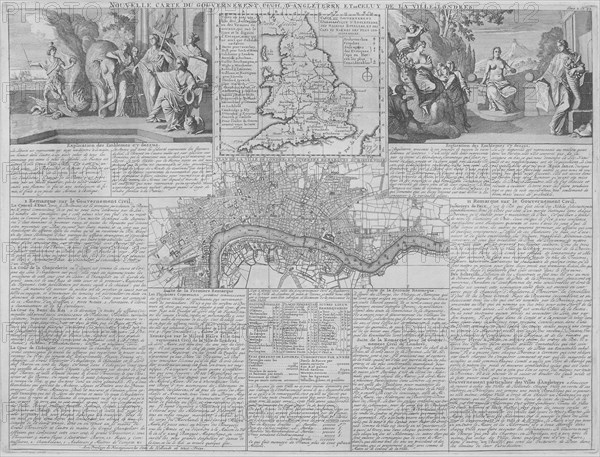
Maps of England, Wales and London, 1718. Artist: Anon
Légende
Maps of England, Wales and London, 1718. A map of England, Wales and part of Scotland is placed between two groups of allegorical figures. Below this is a map of the City of London, City of Westminster, the River Thames, Lambeth, Southwark and surrounding areas. The lower section contains text.
Date
1718
Crédit
Photo12/Heritage Images/City of London : The London Archives
Notre référence
HRM19A97_001
Model release
NA
Property release
NA
Licence
Droits gérés
Format disponible
18.0Mo (1.6Mo) / 24.3cm x 18.5cm / 2875 x 2190 (300dpi)